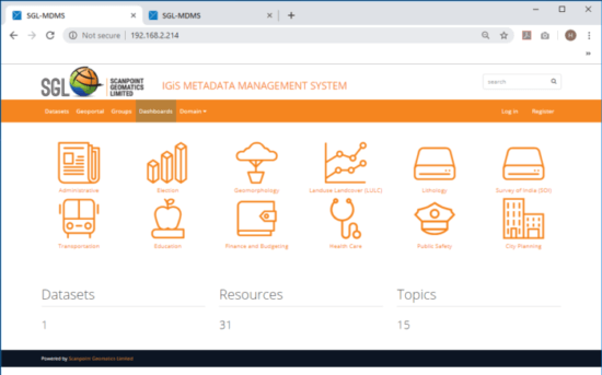
IGiS – MDMS (Metadata Management System) to store, manage, publish, register and securely distribute Geospatial Data collation. IGiS – MDMS is mainly used by organizations seeking to share their data with other geospatial users. It is a high-level platform to develop Spatial Data Infrastructure & Spatial Data Registry solutions.
IGiS – MDMS (Metadata Management System) to store, manage, publish, register and securely distribute Geospatial Data collation. IGiS – MDMS is mainly used by organizations seeking to share their data with other geospatial users. It is a high-level platform to develop Spatial Data Infrastructure & Spatial Data Registry solutions.
IGiS – MDMS is developed based on IGiS – Enterprise Suite with DKAN open data platform. IGiS – MDMS enables world class Geospatial Registry Platform to provide Data & Metadata Publishing, Cataloging, Discovery, Harvesting and Administration. It supports various geospatial and open data standards like ISO TC 211 (19115, 19139), OGC, WMS, WFS, WCS, CSW, INSPIRE, ebRIM, RDF, DCAT, Dublin Core and many more for data discovery and interoperability.
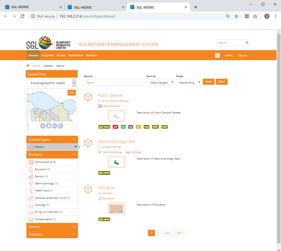
IGiS – MDMS is useful for national and local governments, research institutes, and other organizations which collects a variety of geospatial data and redistribute it. Once data is published, users can use its faceted search feature to browse and find the data they need, and preview it in form of maps, graphs and tables.