How to integrate Spatial Planning and Environmental Management?
How to integrate Spatial Planning and Environmental Management?
In the dynamic landscape of India, the establishment of industries, infrastructures, and the laying of pipelines involves a meticulous approval process from the Ministry of Environment. This process requires stakeholders to submit comprehensive project reports, encompassing diverse information such as LULC, Forest Maps, proximity to villages and railway stations, archaeological sites, soil maps, and geology, along with relevant statistics.
Let’s deep dive into the intricacies of this process, stakeholders leverage GIS & Remote Sensing technology as indispensable tools. The data, sourced from organisations like FSI, GSI, NBSS, and others, is meticulously compiled and transformed into maps that form the backbone of project reports.
In project initiation discussions, there’s a growing emphasis on Environmental Impact Assessment (EIA), a process that evaluates potential environmental effects before implementing a plan, policy, or project. This assessment is crucial to understand and address environmental implications before taking any actions.
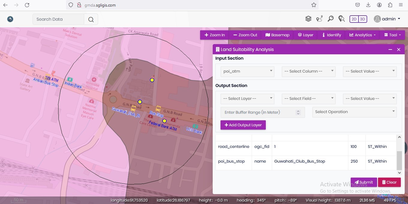
In the modern scenario, stakeholders and decision-makers are paying more attention to enterprise GIS implementation, to efficiently manage spatial and environmental information. This integration of spatial planning and environmental management is crucial for making well-informed decisions and policies about environmental care.
The roadmap to achieving this integration involves:
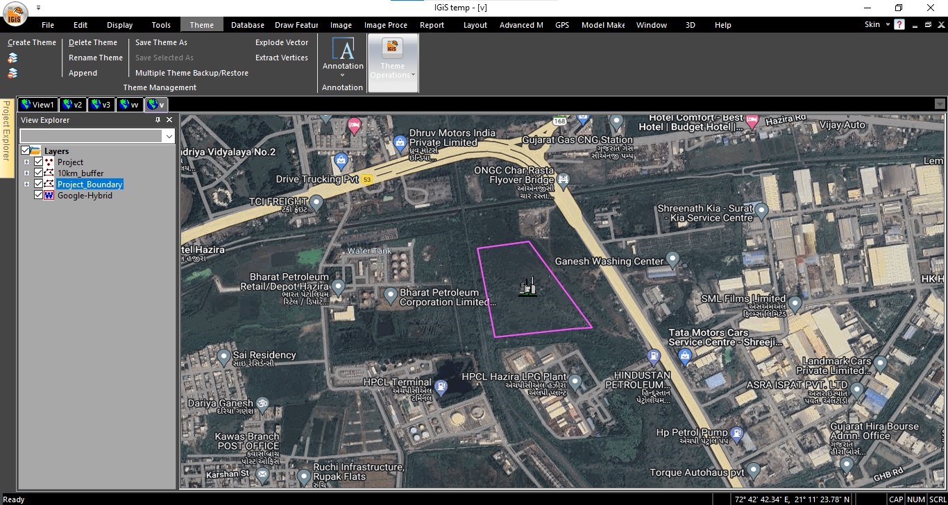
a. Identifying problems and environmental issues within the area of interest
In the context of establishing new industries, infrastructure, or facilities, the initial steps involve identifying the challenges faced by local communities and recognizing the necessary amenities to address these challenges. Subsequently, what comes in front is how that construction will impact the environment/ ecology/ morphology. Hence, we need to consider multiple elements while planning for the construction events. Currently, the integration of GIS technologies significantly reduces manual efforts and improves planning efficiency. These technologies consider various elements at a single time, encompassing physical, environmental, and morphological elements based on the severity of the location of the construction activity. For instance, an industry establishment can have negative impacts on the environment. It’s crucial to prioritize addressing concerns such as pollution sources, potential habitat disruption, water resource issues, endangered species habitats, land degradation, and other area-specific environmental problems to minimize these impacts.
b. Defining objectives and environmental goals
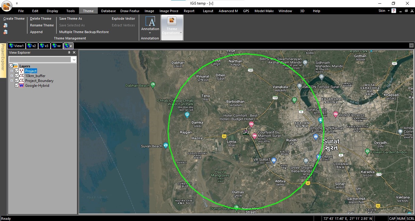
In the context of defining objectives and environmental goals, attention is directed towards a thorough examination of physical, social, economic, and demographic factors beneficial for both the project and the environment. Various industries have diverse impacts on society, demographics, and the environment. The project’s aim involves assessing the potential alterations in land use and land cover due to the industry’s establishment, along with quantifying the impact on air, water, and soil. Quantification of impacts can be done by integrating datasets from local governing bodies, while establishing a relation between the objectives and data, integrating spatial facet to the relation, the objective entails.
c. Planning for necessary actions aligned with environmental issues
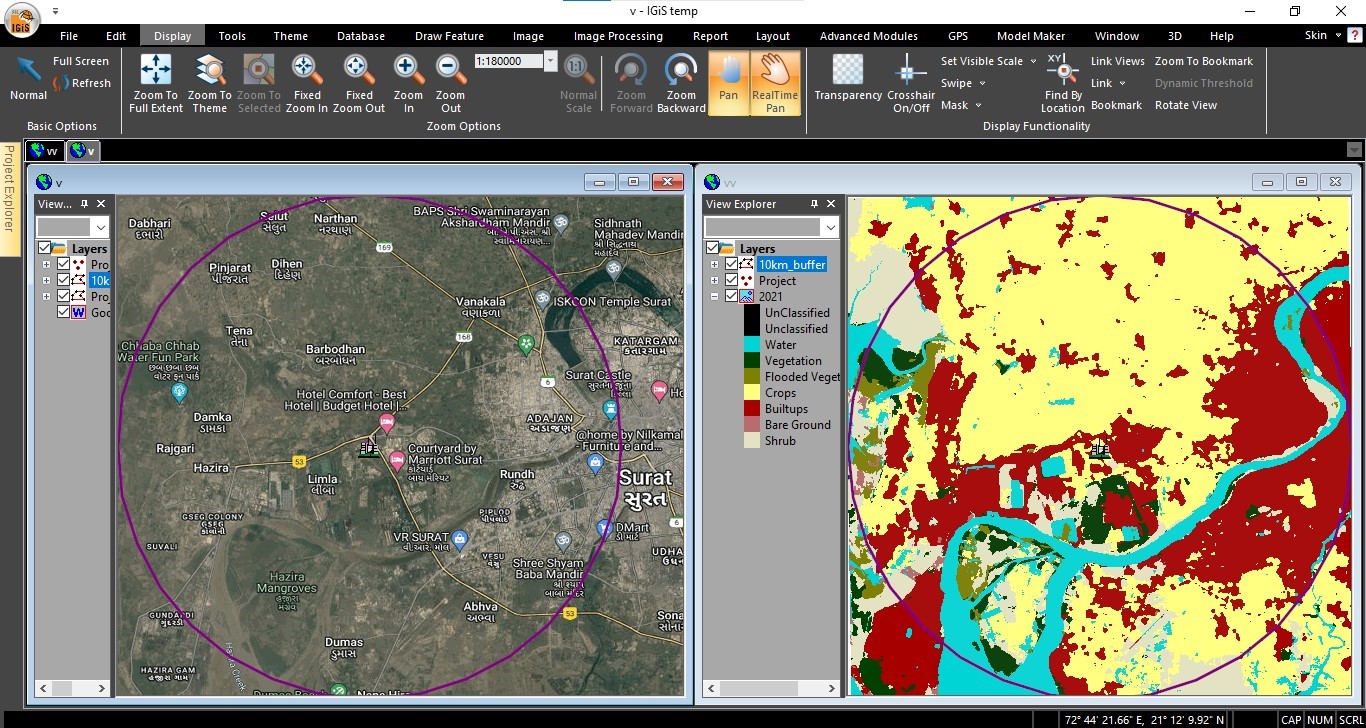
After finalizing the proposed location and objectives, the focus shifts to necessary action planning. During this phase, a comprehensive analysis of all previously considered factors becomes essential. This analysis establishes the connection between developmental activities and their environmental consequences. It might include selecting eco-friendly technologies, designing infrastructure to minimize environmental impact, implementing waste management systems, or adopting renewable energy sources. The goal is to ensure that the industry’s operations are in harmony with environmental preservation. Amalgamating Geographic System and Analytical Capabilities built upon the strategic need of identifying environmental impacts while keeping industry planning in charge. It assists in choosing locations that minimize environmental impact, prioritize accessibility, and factor in elements like proximity to human settlements, transportation routes, and areas with reduced environmental risks. The comprehensive evaluation helps pinpoint the most suitable and environmentally stable locations for the establishment of new infrastructure or industries, ensuring minimal ecological impact.
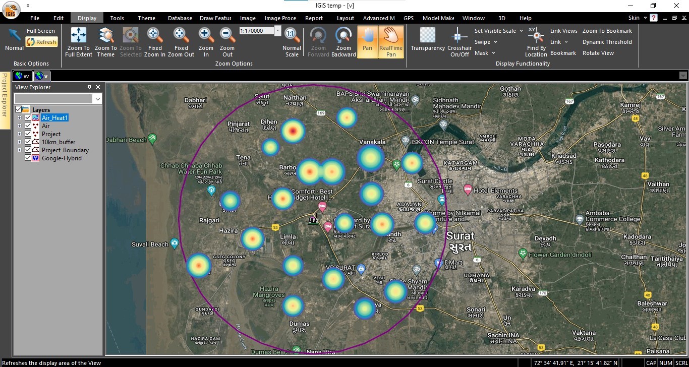
d. Monitoring and analysing spatial data, non-spatial data, and environmental data from IoT/ Sensors on an enterprise platform, facilitated by concerned stakeholders
The mentioned section outlines the data creation and analysis processes, but for policymaking/ decision-making, attention shifts to centralize the geo-spatial, non-spatial and environmental data, its visualization, on-the-fly analyses, modelling, simulations, and report generation. This focus spotlights the role of bringing in enterprise GIS platforms, which serve as vital tools. These platforms aid in storing, managing, and analyzing organization-level data, providing role-based access and manipulation capabilities. Additionally, these enterprise solutions facilitate integration with IoT sensors for real-time updates on information such as air quality, water quality, etc. Stakeholders leverage this data to ensure compliance with environmental regulations during construction, mitigate adverse impacts, and uphold a healthy environment for the local community.
Conclusion:
Geographic Information Systems (GIS), act as a powerful tool that enables the seamless amalgamation of spatial planning and environmental management considering all factors such as, proximity to rivers, settlement, ecological sensitive zone, air quality, water quality, etc. From creating data and visualization to analysis, dissemination of spatial/ environmental data, and integration of IoT devices through enterprise platforms—GIS paves the way for a sustainable and harmonious future. By combining Environmental Impact Assessment (EIA) methodologies with GIS technology, stakeholders can assess, mitigate, and manage potential environmental risks, ensuring that industry establishments align with sustainable practices and environmental regulations. This fusion of EIA and GIS represents a crucial step toward achieving environmentally conscious and responsible industrial development.
Latest Blog

Smart Waste Management with GIS
1. Introduction: Waste management entails the responsible collection, processing, and disposal of waste materials with a focus on environmental preservation. Its core objectives include waste reduction, resource recovery, and the....
Read More