GIS FOR FOREST MANAGEMENT
Forest has an important influence on humans, vegetation cover, animals, plants, soil, stream flow, air quality, microclimate, and even general climate.
In India as per ISFR- India State of Forest Report 2021, the total forest area is 21.71% of the geographical area of the country & estimated country’s tree area covering is 2.91% of the geographical area of the country. Therefore, the total coverage of forests and trees is 24.62% of the geographical area of the country. It is released by the Ministry of Environment, Forests, and Climate Change (MoEFCC). From this, we can easily understand that forest preservation is mandatory and it is also an essential source of life for all living & non-living things. The preservation of the forest always needs forest inventory & it helps to handle the forest data efficiently. The leading advanced Geospatial Technology is widely used to manage the Environment & Forest data for our future sustainability. GIS together with other foresting technologies like Remote Sensing, and GPS, have helped foresters and environmentalists. To provide accurate output with high accuracy information, high-resolution images or detailed information of the input data is always required. This can be enhanced with an end-to-end geomatics solution.
With an innovative approach and attention to detail, Scanpoint Geomatics Limited (SGL) in partnership with ISRO has developed the Integrated GIS and Image Processing Software (IGiS).
What is IGiS?
IGiS is India’s first indigenous and integrated platform that brings GIS, Image Processing, Photogrammetry, and CAD to the Geospatial industry.
IGiS platform enables forest officials to collect, manage, analyze & share spatial data or maps from any device, anywhere, at any time. Additionally, the IGiS platform empowers relevant authorities and departments to nurture data to the same map for efficient management of forest data to preserve the environment and nature. A common IGiS platform gives stakeholders access to share and view data/information, ultimately reflecting to take effective action on risk preparedness.
Scanpoint Geomatics Limited has created holistic applications (Web & Geo-Enabled Mobile) framework on its IGiS GIS & IP software which covers enterprise-wide applications for forest stakeholders.
1. Forest Land Management using GIS
Nowadays Forest Land Management is gradually tough due to population growth, urbanization, climate changes, public demands/expectations, and so on. But the technology-based applications like GIS & Remote Sensing are provides boundless benefits to forest officials who can balance these challenges when preserving, restoring, and managing the forest for a sustainable future.
IGiS enables forest land management officials in the following ways:
» Land Conservation Planning, Monitoring, and Control
» GPS Enabled Mobile App for Forest Land Survey
» Satellite Image classification for Land Encroachment Analysis
» Image Processing application for Classification and Encroachment Analysis.
» GIS base Encroachment Report Sand Penalty Calculation
» Implementation of Land Management Centrally & State Schemes
» Geo-enabled support for planning, implementing, and monitoring
» Geo-enable Support and Compensation
» Compensation for Land settlement etc.
» Geo-enabled wild Land Reports
2. Working Plan Development for Forest using GIS
The GIS for Forest Management plays a major role in the working plan development. The updates & revisions of the working plan are mandatory to keep on engaging the forest preservation and green cover improvement. The input working plan development is given to the forest department to increase the capability in a better way. Using applications of Remote Sensing and GIS technology, the input details such as forest density, forest type, land resources, etc. are provided. Also, maps of road networks, settlements, water bodies, etc., can be included in the work plan development to design efficient management strategies.
How/Where IGiS Can help you with Working Plan Development?
» Logistical Plan for Transport Plan
» Social Forestry & Afforestation
» Geo-Enabled Planning and Monitoring of Social forestry
» Social Involvement Planning Education, Institute, NGO, Corporate, Mining
3. GIS in Forest Monitoring
Forest is a very large area with irregular boundaries. Remote Sensing and GIS in forestry are used to develop a map in a detailed manner easily & digitally. The periodic updates on the forest activity can give more accurate information about the changes or incidents that occurred within and around the forest. All the detailed information can help forest officials to take the decision for making the policies and strategies for sustainable forest management. With the added advantage of monitoring the forests, we can predict or minimize the impact of disasters.
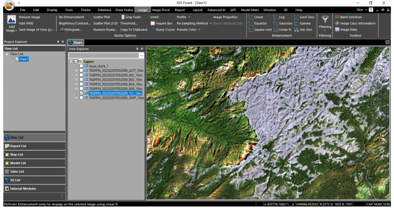
Today, with the combination of multispectral satellite and drone image facilities we can get more precise information about forest coverage. In that, FCC (False Colour Composite) & TCC (True Colour Composite) are playing a major role to identify forest cover changes or activities. The FCC is used to enhance the features available in the satellite image which is not visible to the human eyes.
The IGiS enables Forest Monitoring Officials/Managers to many applications & a few are listed below.
» Plotting of Existing Assets on Map
» Geo enables Assistance to Identify Location & Forecast for the type of Sapling etc.
» Real-Time Data updation on Quantity, Condition, and many others on Central GIS Server
» Drone/Satellite Image Classification Based Plantation Monitoring.
» Geo-Enabled Monitoring of Mangrove Cover and Plantation, Report.
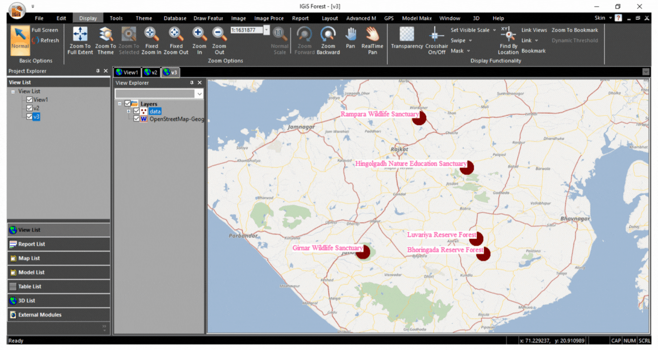
4. Wildlife Management using GIS
Many factors are affecting Wildlife’s health & biodiversity. Especially the consequence of pollution like climate change and so on. The End-to-End Geomatics technology can be used to analyze & envision wildlife data and monitor wildlife performance or effectiveness. GIS enables wildlife management officials/managers to monitor and visualize wildlife movement and habitat limitations. It can also help to provide the action plan for preventing local or global extinctions, rehabilitating wildlife, restoring habitats, etc., using remote sensing technologies.
Areas where IGiS play a vital role:
» Wild Life Conservation Planning and Monitoring
» Map – State/ National Park and Sanctuary, etc.
» GPS Enabled Collar Tracking for Wildlife Movement.
» Geo-Enabled Wild Life Incident Mapping
» Water conservation/Filling Status, Wild Life Disease, Injury, Man Animal Conflicts, and Hunting.
» Implementation of Wildlife Management Centrally & State Schemes
» Geo-enable Support and Compensation
5. Forest Production Management using GIS
Remote Sensing & GIS are paired technology. When it is combined, ultimately provides vast applications in mapping & monitoring in all the domains/ fields. It addresses certain problems and issues for the forest production department. The main objective of the production department is to increase the productivity of the forest in an optimum way (economic & time savings). Here IGiS plays a vital role in forest production management.
IGiS enables officials/managers to provide Location-based Services in Forest Production Surveying & Planning, Grass collection planning, Monitoring of Timber & Fuel Wood extracted by Different Agencies, and many others. Additionally, IGiS can also generate Geo-enabled reports on Circle wise collection of timber & fuel wood.
Here are some Geo-enable services for forest Production management
» Geo-Enabled details of e-Auctions on Map
» Geo-Enabled estimate Growth and Productivity
» Geo-Locations of Saw Mills
6. Forest Vigilance using GIS
The GIS enables professionals to do advanced mapping and spatial analytics for forest vigilance purposes. The advanced mapping & spatial analytics includes monitoring of species, human-animal conflict, management of protected areas, etc. These results are strengthening vigilance to safeguard wildlife habitats and prevent poaching and other illegal activities.
IGiS Used for Forest Vigilance Department
» Web-Enabled Forest Guard Dynamic Route Planning
» Geo -Enabled Mobile application for Capturing Field Information
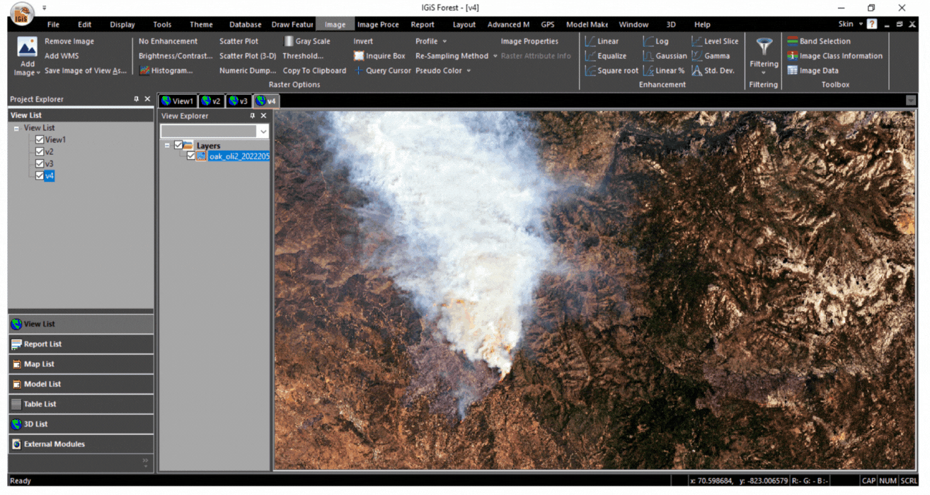
» Tree Cutting, Encroachment, Wild Life Poaching, Water Status, Forest Theft, Forest Fire, Animal Sighting, Assessment of Damage due to Disasters, Rescue & Release, Forest Crime
» Hot Spot capturing and Analysis
» Assault on Forest Officer, Poaching and Produce Theft, etc.
» Route Tracking and Analysis
» Basic Tools for Forest Guard Assistance
» Geo-Tag Photograph & Video, Measurement Tool, GIS Editing Tool Spatial and Attribute, Forest Fire and Other Incident Analysis Heat Map and Report.
7. Forest Tourism using GIS
Geospatial technology provides more prospects for the development of modern tourism applications using maps. This technology integrates the forest database (boundary, protected or reserved areas, road, settlement, waterbodies, etc). It provides information as per the user queries with the geographic analysis & ultimately it leads to benefits offered by maps.
A few more services by IGiS are listed below in the Forest Tourism Department.
» Geo-Enabled Web Portal for Tourists
» Important Features/Spot Locations, Animal Sight Locations, Hotel/Guest House Locations, Geo-Enabled Information Brochures.
» Geo Enabled Mobile Application for Tourist
» Geo-fenced Information over Mobile, Geo Enabled Augmented Reality base Location finder.
8. Capital Project Monitoring using GIS
GIS platform acts as a backbone for the database. From this database, easily Capital Project Monitoring can be done through share the status or updates of projects with internal and external stakeholders.
Few Areas where GIS plays a vital role:
» Road Repair, New Road Constructing, Forest Building Construction, Tribal Toilet Construction, Century Development & Construction, Water Pit Construction, and Construction of parapet walls and open wells.
» Map Handling Module
» Compile & a proper GIS view will be provided to analyze existing geolocation
» Decision can be taken looking at GIS View for suitability of the project.
» Work in Progress
» Monitored and controlled through application by incorporating GIS/project Work in Progress through GPS base Tagging and GPS enabled Photos etc.
» Functions for analysis like Buffer, Measurement, Vector overlay, Colour, Symbology. With the following sub-modules:
» Spatial Query Module will allow users to create buffer Analysis, Change Analysis, and Image Analysis over Vector.
» Geo-Enable Monitoring of MGNREGA (The Mahatma Gandhi National Rural Employment Guarantee Act) Yojna
» Reports user can prepare Project Development Reports, and various BI reports.
» Payment to vendors against actual Monitoring of work in GIS
9. CAMPA using GIS
Compensatory Afforestation Fund Management and Planning Authority (CAMPA) uses GIS technology to do many activity plans. Especially, GIS is playing a major role to find the land/location suitability for construction or establishment works. Such as the erection of dams, mining, and construction of industries or roads.
10. Geo-Enabled Portal using GIS
The development of a geo-enabled portal leads to the communication of internal & external Stakeholders. Recently, the Geo-enabled Portal and Ladakhka forest portal were developed for citizens & tribes.
Get in touch to know more about our geo-enabled portals.
CONCLUSION
The evolution of Remote Sensing, GIS, and Global Positioning System (GPS) technologies has enabled many services digitally. Digital services ultimately provide many benefits: to save time, money, and manpower to make better decisions, and improve productivity in forest management activities. The significant applications of geospatial technology discussed in this blog are complete evidence of the GIS technology’s potential in the future. Last but not least, utilize the technology for a better & healthy environment to preserve nature.
Latest Blog

Smart Waste Management with GIS
1. Introduction: Waste management entails the responsible collection, processing, and disposal of waste materials with a focus on environmental preservation. Its core objectives include waste reduction, resource recovery, and the....
Read More