GIS Applications For Agriculture
INTRODUCTION
As everyone knows, agriculture plays a vital role in India’s economy. Despite an increasingly urban population, agriculture and its related sectors remain the main source of livelihoods in rural India. Sustained progress in agriculture and related activities in India has been possible due to boosts provided by the green revolution, white revolution, yellow revolution, and blue revolution. (https://www.india.gov.in/topics/agriculture).
The Green Revolution was a series of research and technology transfer activities to improve agricultural productivity. Along with other technologies, GIS has emerged as one of prominent technologies for agricultural sector. GIS or geospatial technologies find direct applications in the assessment and improvements of agricultural productivity, which has contributed to better food security. Geospatial technologies have helped agriculture in peripheral sectors like sustainable management of natural resources, protection of biodiversity, and many others.
IGiS – A product jointly developed by Scanpoint Geomatics Ltd & ISRO offers an integrated geospatial platform that integrates diverse technologies such as GIS, Image Processing, GNSS, Photogrammetry and CAD. This kind of comprehensive range of technologies on a single IGiS platform has found applications in multiple sectors, including agriculture.
IGiS offers an end-to-end solution for agriculture as an Agriculture Information System (AIS). It is used for creating Intelligent Maps which helps to monitor crops, vegetation health, Soil analysis, Crop yield estimation, etc. IGiS – AIS is the GIS-based technology intervention that provides actionable insight by analyzing remote sensing data captured at regular intervals throughout the crop period. This information can be disseminated to all the stakeholders through the web and or mobile for timely actions.
Significant applications of GIS in Agriculture
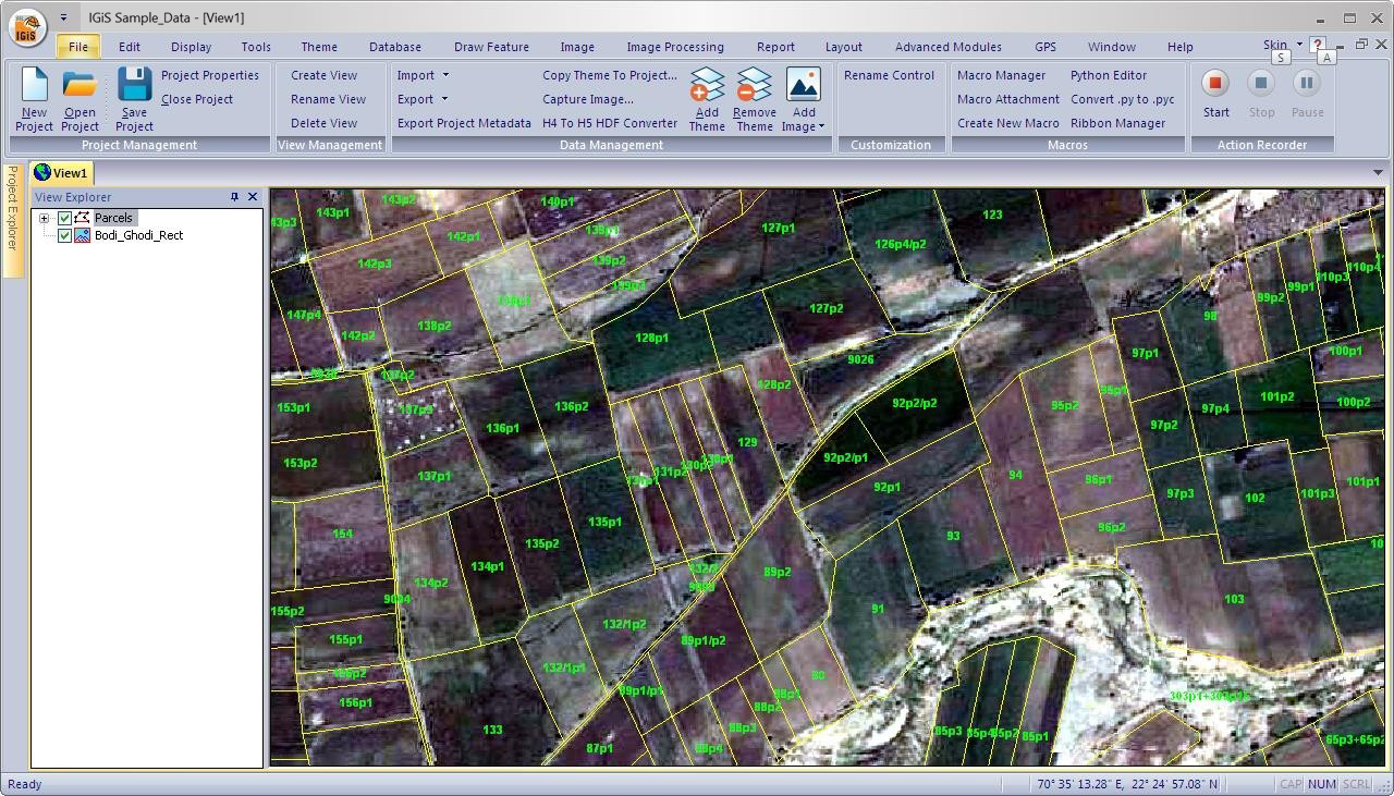
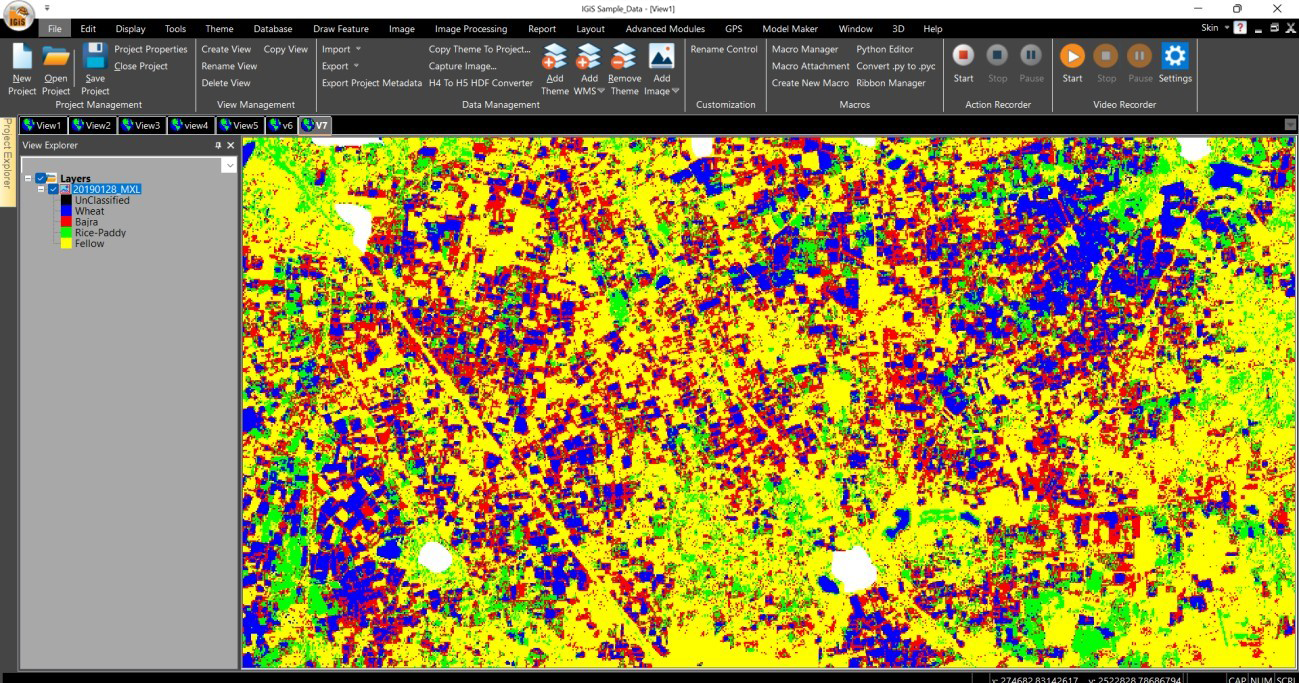
1. Crop Sown Area Estimation: Remote Sensing plays a crucial role in mapping and monitoring of various crops sown area in different agro-climatic zones and different crop seasons such as Kharif, Rabi and Zaid. IGiS being an integrated GIS software, supports the ingestion of various satellite data such as Optical, SAR and Hyperspectral imageries to provide an accurate area sown under a given crop in all weather and climate conditions by integrating with plot level maps (cadastral maps).
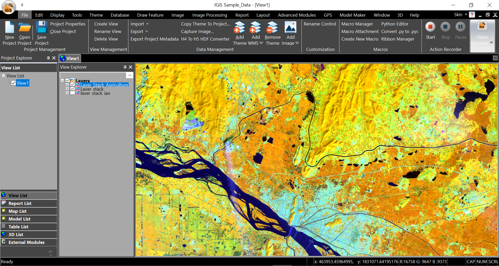
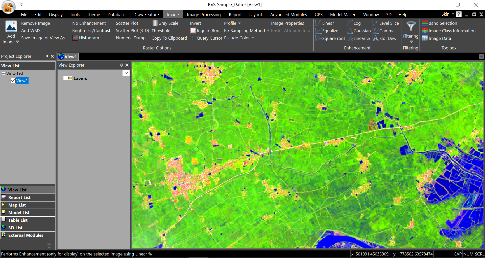
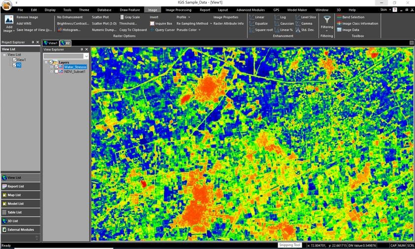
2. Crop Condition Assessment: Crop condition assessment is important for improvement of crop yield by continuous monitoring and timely interventions at the onset of problems. Crop condition assessment is the evaluation of crop’s health based on insect attacks, moisture deficiency, fungal and weed attacks, etc. In particular, Remote Sensing and GIS techniques are used to visualize field data on a map for further planning or analysis activities. Remote Sensing technology supports frequent imaging using satellite/drone band combination to identify the crop conditions. IGiS enables fast and comprehensive processing of satellite or drone images to produce crop maps along with various health indices like NDVI (Normalized Difference Vegetation Index). NDVI is used to assess crop health precisely. Depending on data resolution, IGiS can provide micro-level crop assessments like crop classification, sowing patterns, unhealthy crops, etc.
3. Crop Production & Yield prediction: The main objective of farming is to get a high crop yield with good quality. For that, geospatial technology plays a role in providing actionable insights for increasing crop yield by predicting the expected crop production in a particular area under specific conditions. IGiS’s analytical and powerful data management tools provide managers and farmers with a reliable solution for timely and better crop management to make the right decisions about yield estimation. This reliable solution of yield prediction can help policymakers, researchers, and various other agriculture stakeholders to ensure food security and forecast profits over a given period of time. Various yield simulation techniques and algorithms like Machine learning, Deep learning, Artificial Intelligence, Neural network and IoT (Internet of Things) can help to identify the crop type and accurate prediction of crop yield and production.
4. Crop insurance and Loss Assessment: In the period of catastrophic events like hail- storming, flood, hurricane, heavy rainfall, drought etc. remote sensing technology can be used to determine exactly how much of a given crop has been damaged and the progress of the remaining crop in the farm. IGiS’s Image Processing – Transformation functionalities support satellite imagery analysis & various spectral indices like NDVI, NDWI, etc. are used to monitor crop growth and health and other environmental conditions across the field, such as humidity, air temperature, surface conditions, drought, etc. IGiS can generate crop condition and distribution analytics suitable for crop insurance settlements.
5. Crop suitability Analysis and Land Use Planning: An integrated IGiS Suite provides an excellent platform for assessing the quality of land, selection of suitable crop sown & agriculture applications. A Multi-criteria decision-making (MCDM) approach based on GIS is used for land use planning. By mapping different features such as soil type distribution, soil texture map, Soil pH value, soil fertility distribution, slope (S), soil texture (ST), depth to water-table (DTW), climate conditions, topography, and satellite data, allows to identify the impact of interacting factors on crop suitability and site specific crop management. An Integrated fuzzy logic and GIS model will be used to analyze land suitable for precision farming.
6. Drought Monitoring & Crop Water Requirements Analysis: Weather patterns, drought occurrence patterns, are monitored using remote sensing technology over a given area. The technology enables the decision maker with forecasting details of rainfall & so can conclude on drought situation.. IGiS supports active and passive sensor images & helps to determine soil moisture content and estimating the water content in field crops. It helps in planning field level irrigation & field management.
7. Smart Farming: Smart farming is based on the use of geospatial and digital data for crops being grown through the entire crop period and helps to improve the effectiveness and efficiency of crop management practices. The digital map or data access of the farm or agricultural land ultimately leads to betterment of the crop yield, quality, and hence profit, by optimising the use of fertilizer, pesticide & water. These digital or spatial data enable the managers or farmers to take the right decision in the right situation to optimize the agricultural processes.
CONCLUSION
The geospatial technologies on the IGiS platform help to provide comprehensive solutions in the agriculture sector through its interventions in crop production estimation, yield forecasting, crop condition assessment, crop insurance and crop area enhancements. IGiS makes it possible to derive and use various agriculture related parameters like Soil Properties, Soil Moisture, Flood Impact, Agriculture encroachment, change detection analysis.
Further advances in geospatial techniques and computing infrastructure will allow the development of comprehensive collaborative framework amongst scientists, policymakers, researchers, extension personnel, crop consultants and other stakeholders with practical guidelines for effective management of crop yield estimations, soil fertility, cropping pattern and monitoring, drought risks, and fertilizer and weed management.
Latest Blog

Smart Waste Management with GIS
1. Introduction: Waste management entails the responsible collection, processing, and disposal of waste materials with a focus on environmental preservation. Its core objectives include waste reduction, resource recovery, and the....
Read More