Navigating the Third Dimension: Exploring Possibilities with IGiS 3D
Introduction
Traditional GIS data and mapping are limited to two dimensions, i.e. x and y-value, which can impose certain constraints in some applications. Consequently, the integration of z-value into mapping brings an additional dimension to data collection and analysis with 3D GIS, in lieu of expanding the depth of spatial information.
In the arena of geospatial technology, the combination of 3D visualization and Geographic Information System (GIS) has brought about notable advancements and achievements in data analysis and visualization.
In this blog, we will explore the competencies of IGiS 3D Pruthvi and by what means it is transforming the approach of 3D visualisation and analysis. Additionally, we will discuss the advanced visualization and spatial analysis tools offered by IGiS 3D Pruthvi in improved decision-making processes.
About IGiS 3D Pruthvi
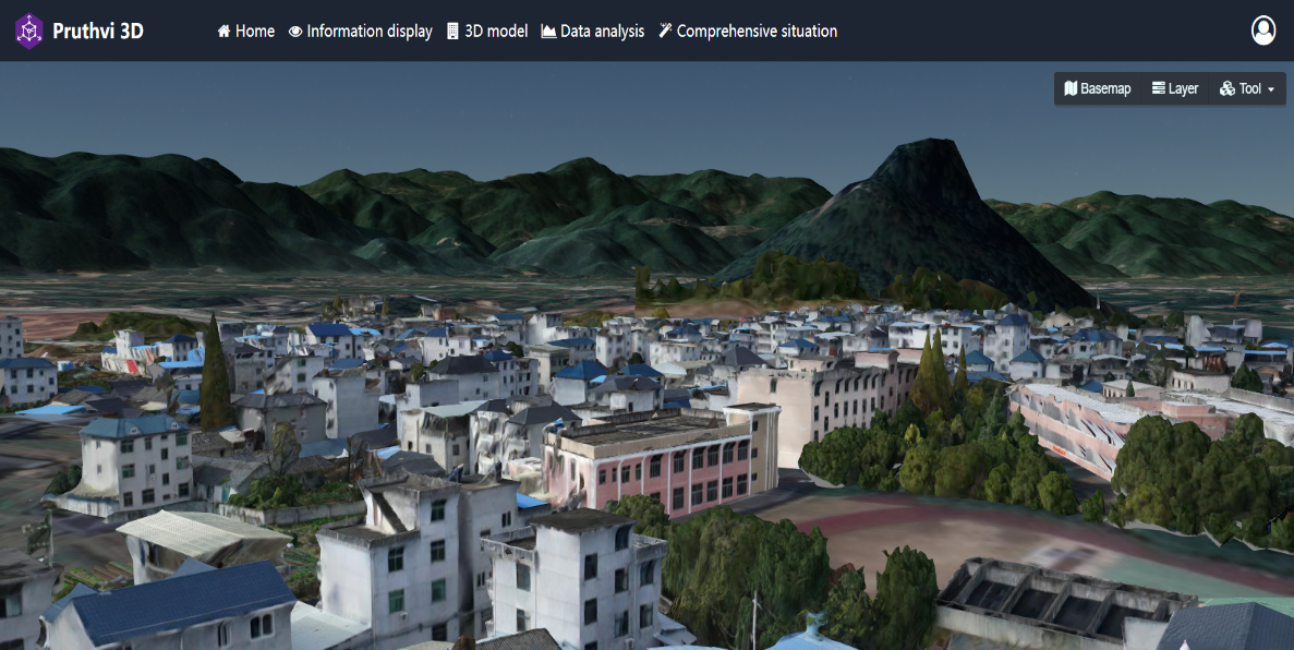
IGiS (Integrated GIS & Image Processing Software) is a comprehensive platform jointly developed by Scanpoint Geomatics Limited and ISRO which has integrated GIS, image processing, and photogrammetry as a single Point solution along with its 3D module i.e. IGiS 3D Pruthvi. IGiS 3D Pruthvi is an end-to-end 3D GIS solution that allows the user to create, process, viewing, and analysis capabilities of 3D geospatial data. It serves multiple sectors like urban planning, architecture, engineering, environmental management, virtual city models, and transportation networks, defence sectors as a tool for better decision-making and resource allocation optimization through spontaneous communication of geographic information.
» Data Support and Analytical Tools
– Data Supports:
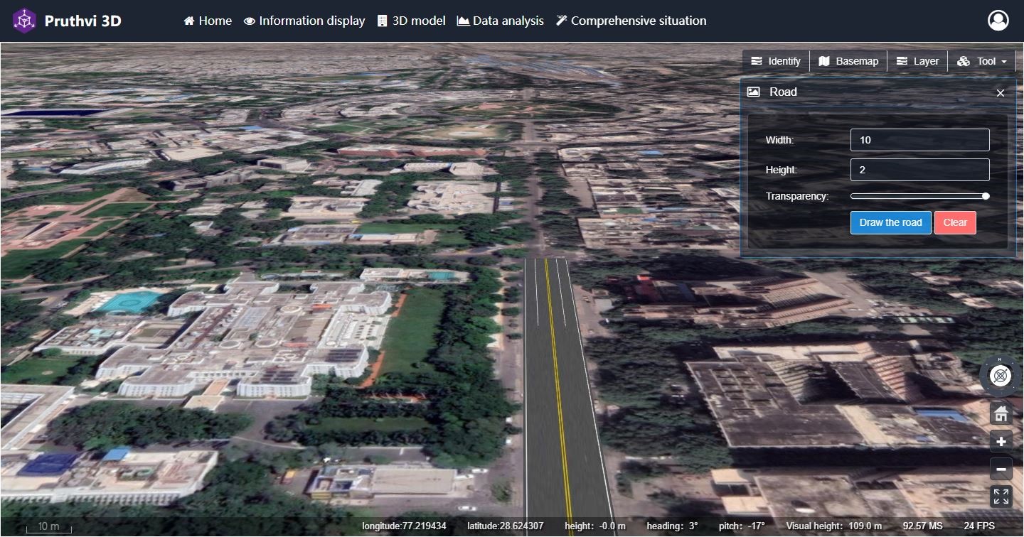
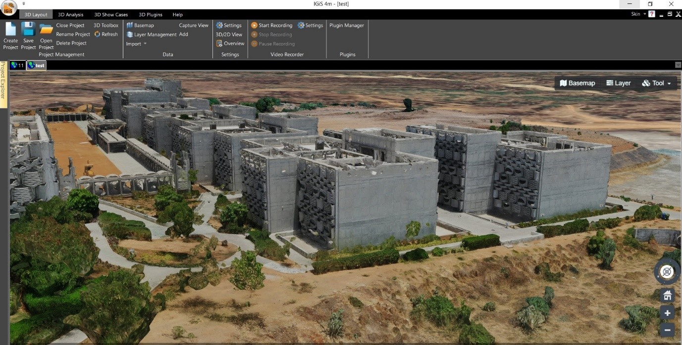
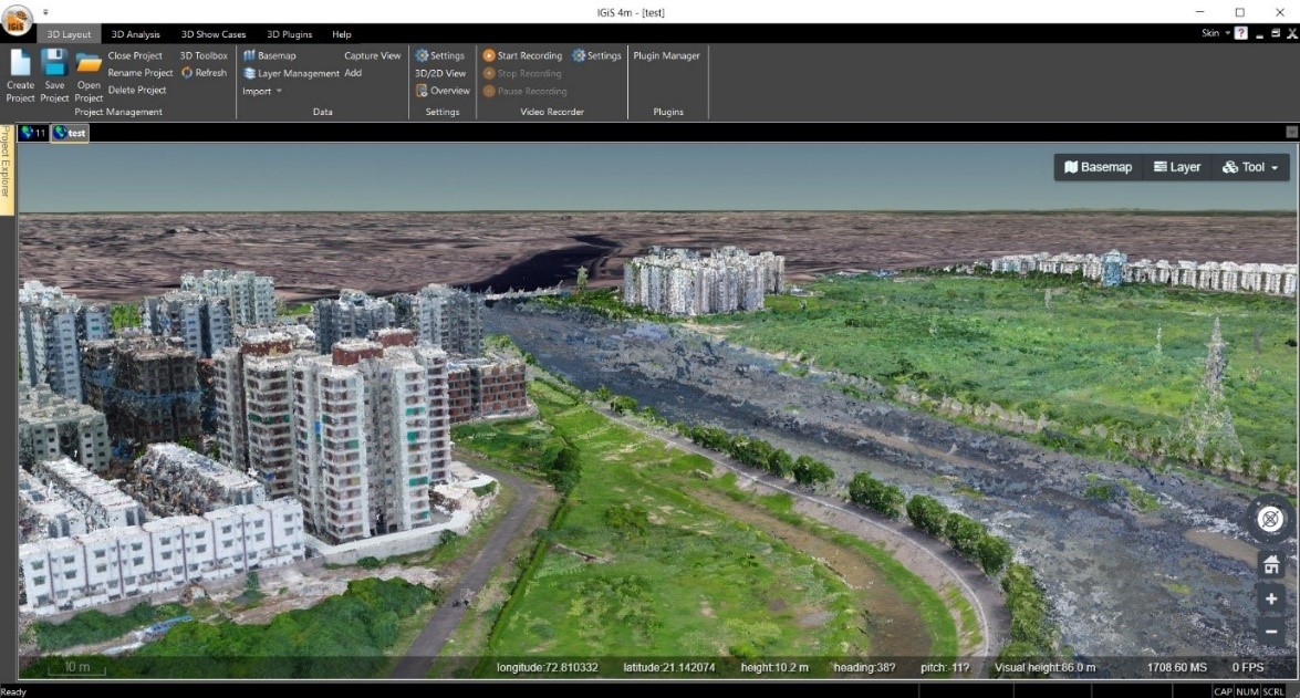
IGiS 3D viewer is a powerful tool that allows users to work within a 3D environment, offering functions like importing, managing layers, switching base maps, and capturing views. It supports 3D, 2D, and 2.5D data visualization, where 2.5D displays surface data with height values over an area. The software is compatible with various data types, including Image Tiler, Building Tiler, Photogrammetric data, 3D scan data, CAD files, shape tiler, and Point cloud data sets.
– Analytics Modules:
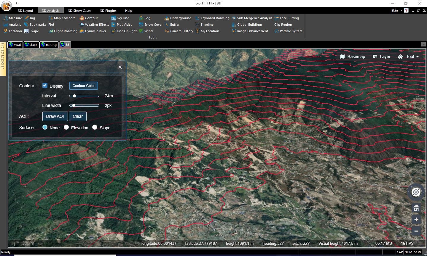
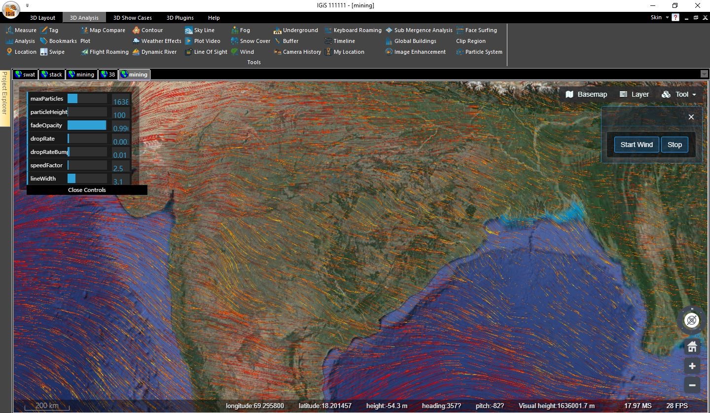
In the 3D Analytics section, IGiS provides a diverse set of measurement tools such as Sunshine Analysis, floor area calculation, ground area calculation, Dynamic modifications of 3D Models, triangulation generation, Cross sectional profile generation, as well as capabilities to find slope and aspect of the land, create dynamic contours, perform variance analysis, and utilize terrain excavation functionality. Additionally, it allows Dynamic river mapping, flythrough simulation, Submergence analysis, underground analysis, Dynamic line of sight generation, and location fetching facilities, environmental parameters and its simulation like Wind, Snow and Rainfall etc. In summary, IGiS offers extensive spatial analysis and visualization capabilities within its 3D environment.
– Applications of 3D GIS
The applications of GIS and 3D are numerous and diverse. Here are some potential applications of GIS and 3D in different sectors using IGiS Pruthvi:
– Urban Planning
In the field of urban planning, GIS and 3D applications have revolutionized the way we create more liveable and sustainable cities. 3D models of urban areas permit planners to envision a range of different things from land use to various network systems. Urban planners are increasingly using these applications to model and analyze urban landscapes, assess the impact of new developments, and identify areas that require infrastructure improvements.
- Urban Planning and Design: 3D GIS allows urban planners and architects to create 3D models of cities and visualize the proposed outputs. This technology helps in understanding the impact of new constructions, urban renewal projects, or infrastructure changes on the city’s overall landscape and its citizens.
IGIS 3D Pruthvi comes with an out-of-the-box facility to cater for these needs of the hours.
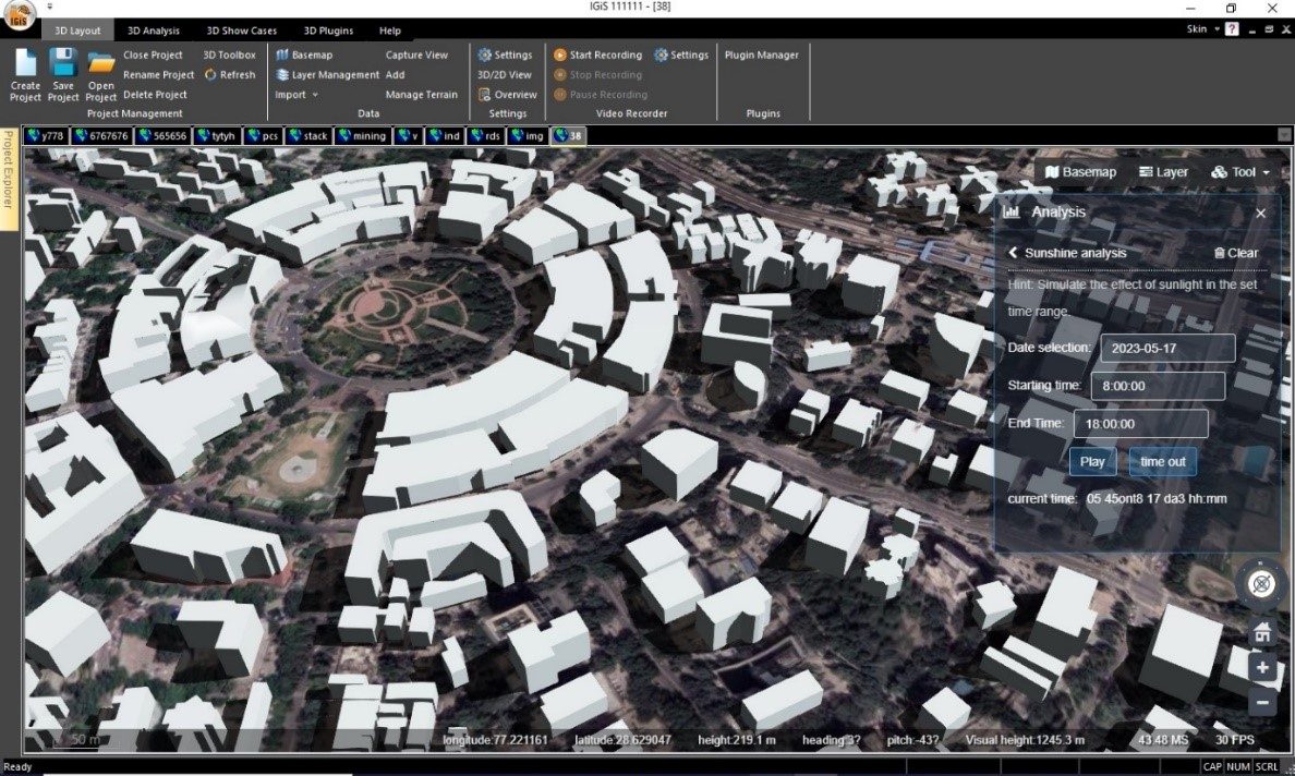
- IGiS 3D Pruthvi offers the capability to enhance the efficiency of visualizing the interaction between sunlight and a specific geographical area. It provides a means to comprehensively understand how sunlight’s illumination dynamically changes over the course of a particular day. One of the key features that contributes to this enhanced visualization is the Sunshine Analysis function within IGiS 3D Pruthvi. This feature empowers users to create simulation-based models that accurately depict the patterns of sunlight as they fall onto the designated area and evolve over time. Imagine a person is present in a park, and want to understand how sunlight will cast shadows, create highlights, and affect the overall ambiance throughout the day. Using IGiS 3D’s Sunshine Analysis, user can input the geographical details of the park and set a specific date and can dynamically visualise the scenario.
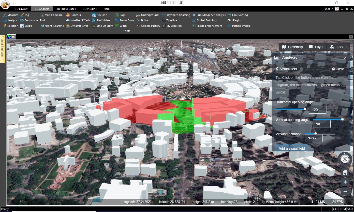
- The visual field tool combines GIS data and 3D modelling to offer a highly realistic visualization of CCTV based cameras. It helps to identify their coverage areas and potential obstacles while considering line-of-sight analysis, ensuring optimal coverage with minimal blind spots.
- 3D GIS enables better terrain analysis by considering terrain, buildings, and other physical features. Before planning for any kind of construction activity user can take the help IGiS 3D Pruthvi to prepare a simulation modelling based on slope, aspect, height and curvature of the land dynamically to get an idea about the construction’s floor area, if any types of depositional/excavation activates area required etc.
- Utilizing IGiS 3D legend creator tool urban planner can generate different theme based maps. Through the analysis and visualization of thematic geo-spatial datasets in 3D environment, planners can approach to urban development precisely.
- Urban area growth can be analysed by leveraging time stamp data and employing time series analysis tool within IGiS 3D environment, thus providing valuable insights into the temporal dynamics and spatial patterns of urban development.
– Architecture Planning
In architecture, IGiS 3D applications can be used to enhance the design process and provide more accurate and detailed visualizations of proposed buildings. These applications allow architects to create immersive experiences for clients, providing them with a realistic view of how their projects will look and feel in real-world contexts.
IGiS 3D Pruthvi is a powerful platform that enables GIS professionals to analyze and model complex spatial data, such as terrain, building models along with the support of LOD1, and LOD2 data for standard OGC 3D building formats with textures. This with functionalities of roaming/ flight roaming can lead the architectures for better planning of buildings, especially in the case of fire escape planning.
IGiS 3D Pruthvi is useful for landscape architecture, allowing professionals to create more sustainable cities by analyzing and visualizing the impacts of proposed developments on the broader built environment. The platform enables architects to integrate GIS data into 3D architectural models, which can help to create more comprehensive and sustainable designs. It has the supports of different photogrammetric products format such as .obj file, cad file format like .dae, three-dimensional scenes and models file format like .gltf etc. for importing and visualising the 3D models in IGiS 3D environments.
– Engineering Applications
GIS and 3D applications are utilized in engineering sectors to streamline the planning and design process. With IGIS 3D application, engineers can create complex and precise models of different infrastructures by identifying potential issues and optimize designs before the construction process begins in a three-dimensional context.
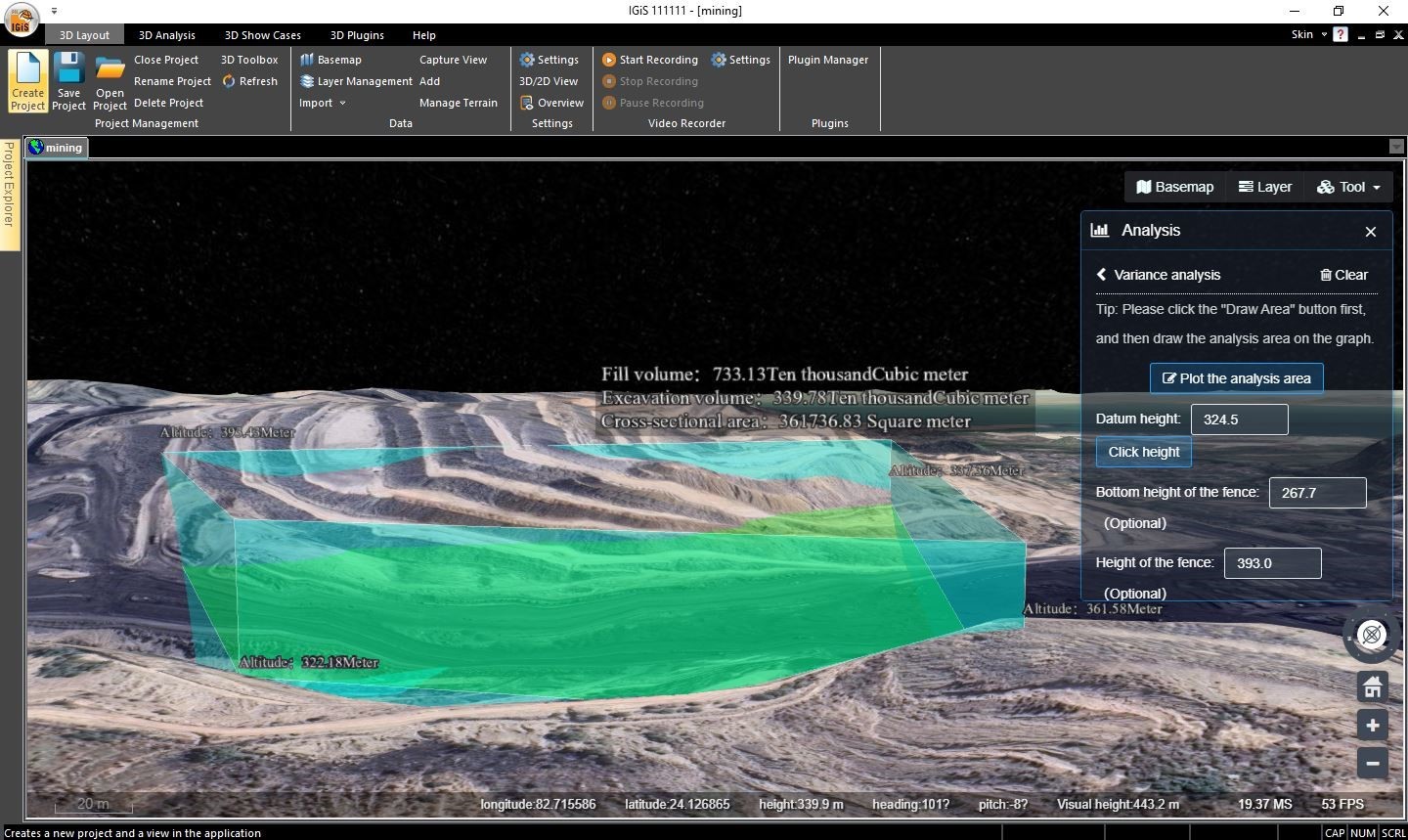
Engineers can utilize IGiS 3D to conduct precise cut and fill volume calculations for earthwork projects through the Variance Analysis tool. The Terrain Excavation tool complements the capability by ensuring accurate terrain modelling and material quantity calculations, streamlining earthwork operations. Consequently, this process leads to cost reduction and increasing efficiency.
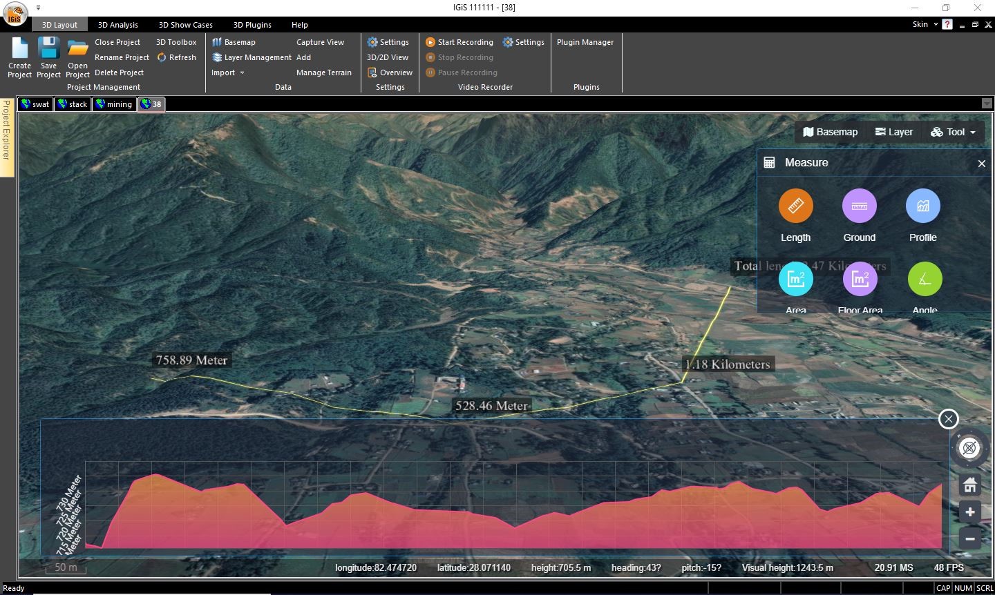
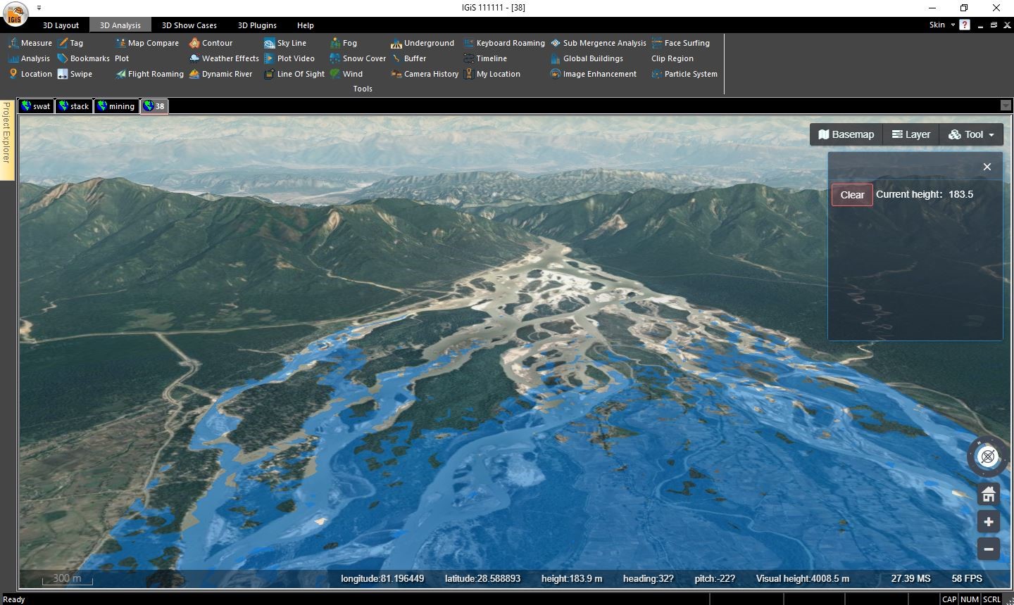
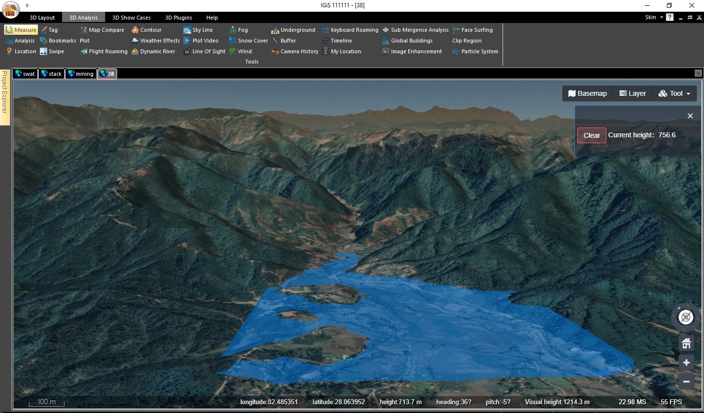
IGiS 3D empowers engineers to analyze slope, profiles of the land, which allows them to develop equilibrium measures to mitigate risks associated with steep terrain. Moreover, IGiS 3D provides the support for evaluation of flooding areas, particularly in dam and reservoir construction projects. This enables engineers to efficiently plan the overall structure and devise mitigation strategies while taking into account environmental impact assessments.
3D GIS plays a vital role in the Environmental Management domain, providing a powerful set of tools to analyze, visualize, and manage complex spatial data related to the environment such as
– Natural Disaster Management
GIS and 3D applications are widely utilized in natural disaster management. They help to map and analyze disaster risk and plan for emergency response.
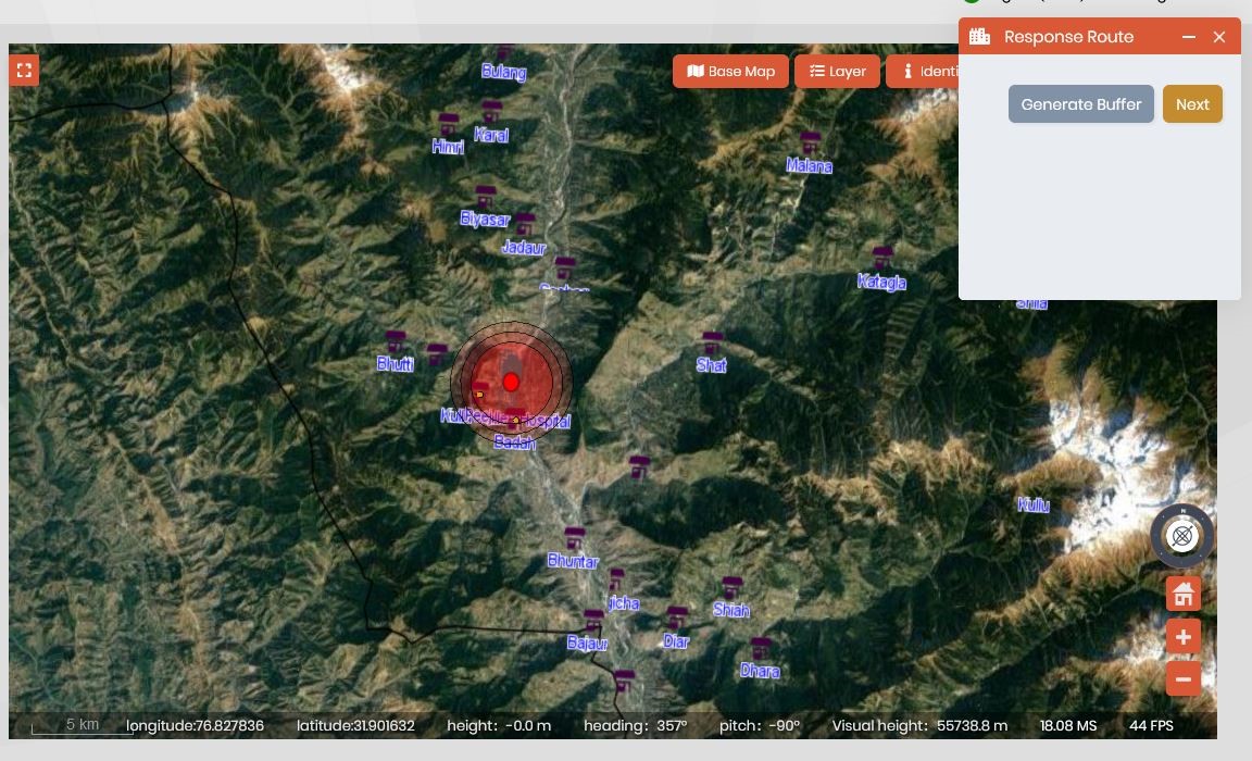
IGiS 3D technology can be utilized to mark disaster areas, generate buffer zones around them, and locate nearby emergency services within those buffer zones. In this disaster management context, user can use the Submergence analysis tool which offers several benefits for assessing the potential impact of flooding or submergence on an area. Additionally, IGiS 3D Pruthvi can also integrate third-party applications with time series data and track the movement of natural disasters such as hurricanes, floods, and wildfires, allowing authorities to provide timely warnings to residents and minimize the potential loss of life.
– GEO-Intelligent-based Analysis
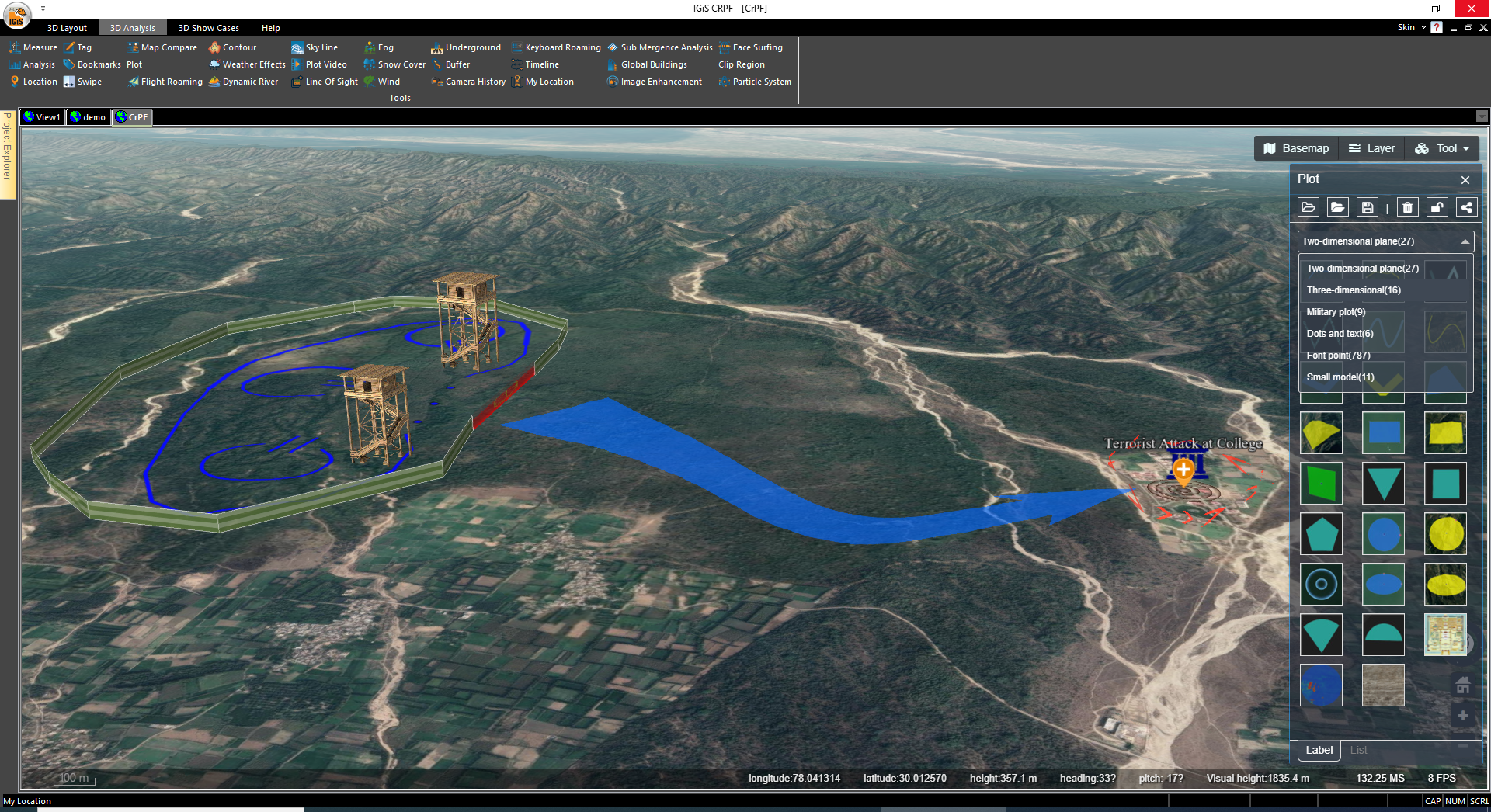
3D visualization holds significant importance in military applications due to its ability to enhance situational awareness, aid decision-making, and improve operational effectiveness. It provides better situational awareness, helps in mission planning and rehearsals, intelligence analysis, etc. IGiS technology provides inbuilt functions to perform 3D analysis by using terrain data and satellite imagery. IGiS also comes with in built support of creating 3D spatial tiles which provides defence users with various analytical power in three dimensional arena. It is equipped with tools like Line of sight, 3D volumetric analysis, View shed analysis, on-the-fly slope aspect and contour generation with 3D fly thorough simulation. These tools equips defence sector with a facility of robust tactical planning and as a result minimise manual planning efforts and have the potential to heavily decrease defence losses during live operations.
Conclusion
In conclusion, IGiS 3D Pruthvi with its advanced 3D capabilities, enables users to explore and understand spatial data in a more immersive and comprehensive manner. It facilitates the integration of various data sources, including satellite imagery, LiDAR data, Shape file, CAD data, and elevation models. Its applications are diverse and span across various industries, contributing to smarter decision-making.
Overall, IGiS 3D is a valuable tool for harnessing geospatial data, enabling better understanding, analysis, and management of the physical environment.
Latest Blog

Smart Waste Management with GIS
1. Introduction: Waste management entails the responsible collection, processing, and disposal of waste materials with a focus on environmental preservation. Its core objectives include waste reduction, resource recovery, and the....
Read More